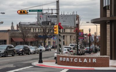
With just under a year until the world’s biggest soccer tournament kicks off on U.S. soil, one Montclair business is already gearing up to make it a celebration to remember.
Leo Sawadogo, co-owner of Montclair Brewery and a former professional soccer player from Burkina Faso, has big plans to blend his two passions—beer and the beautiful game—as the FIFA World Cup 2026 approaches. With matches set to take place just 20 miles away at MetLife Stadium in East Rutherford, the global event is expected to bring significant economic and cultural energy to northern New Jersey.
“We’re definitely doing something special,” Sawadogo said in a recent interview. “Probably for the teams. There’s a lot I can’t talk about… all that is in secret. But if Ghana is coming, expect a beer with something from Ghana.”


Sawadogo, whose first love was soccer, played professionally in the Ivory Coast before an injury cut his career short. But the game never left him. After moving to Montclair, he began coaching local youth teams in 2010 and eventually opened the brewery with his wife, Denise, in 2018. Soccer, it turns out, was part of the brewery’s origin story too.
“I started brewing because of soccer,” Sawadogo said. “The kids that I used to coach on the field, we all had a dream. The kids wanted to play professionally. They asked me, ‘Coach, what do you want to do when you grow up?’ I told them, ‘I want to build a brewery.’”
The FIFA World Cup is expected to be a major boon for local businesses. As soccer fever builds, entrepreneurs like the Sawadogos see an opportunity to create community-centered experiences around the tournament. Sawadogo says Montclair Brewery will roll out themed beers, host match screenings, and even launch a new podcast to keep fans engaged.
“I started brewing because of socce. The kids that I used to coach on the field, we all had a dream. The kids wanted to play professionally. They asked me, ‘Coach, what do you want to do when you grow up?’ I told them, ‘I want to build a brewery.’”
leo sawadogo, co-founder of montclair brewery
“The podcast is to talk about soccer,” he said. “I constantly tell people, if I get cut, instead of blood, you probably see tiny balls coming out.” He laughed, then added: “We want to start a countdown, talk about what’s gonna happen, the big players coming up. And hopefully we’ll find people who are as excited as we are.”
More than just a commercial venture, Montclair Brewery has long positioned itself as a gathering place for families and soccer lovers alike. Alongside their popular craft beers, the brewery offers non-alcoholic drinks inspired by Sawadogo’s childhood, such as hibiscus, pineapple-ginger, and root beer—designed with children and non-drinkers in mind.
“When we were working with the township, we told them we wanted this to be a family place,” he explained. “My mom used to make non-alcoholic drinks, so we make those too. For the kids that come with mom and dad to sit down and hopefully watch a game.”
As the countdown to kickoff continues, Sawadogo says the most meaningful moments often come not from the pitch, but from the people. “When the kids I coached won the state championship, they came back to celebrate here,” he recalled. “They showed me their championship rings. That made me proud. And all of that’s because of soccer.
You may also like…
- The Montclair Pod News: School Lunch Drama, The Cheapest Gas Station, and a $10 Million Bond for Town Improvements
- The Montclair Pod News: High School Ranking Drops, $7.5M Property Hits Market, and Daikichi Return-Rumors
- The Montclair Pod News: Lead Pipes, Stolen Mail, and a Century-Old Substation
- The Montclair Pod News: The NJ Governor’s Race, Shuttle Bus Survey and Debate, Dining Updates, and More from August 14, 2025
- Things to Do, See and Experience in August: MedievalFest, End of Summer Escapes, and an $11 Million School Surprise


